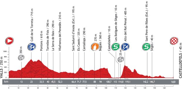
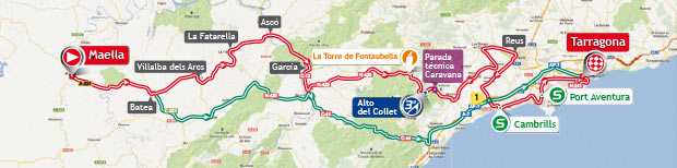
Vuelta a España 2013 stage 12 is a plain stage from Maella to Tarragona. The length of the course is 164.2 km. Despite there is a 3rd category climb in the middle of the route, the stage is suitable the pure sprinters, because there is a lot of flat course after that climb. The general classification contenders will want to save their energy just two days before reaching the Pyrenees.
Previous Stage: Vuelta a España 2013 Stage 11 details
Next Stage: Vuelta a España 2013 Stage 13 details
Vuelta a España 2013 stage 12 quick info
- DATE September 05, Thursday
- STAGE TYPE Plain
- START-FINISH Maella (315 m) > Tarragona (40 m)
- STAGE DISTANCE 164.2 km
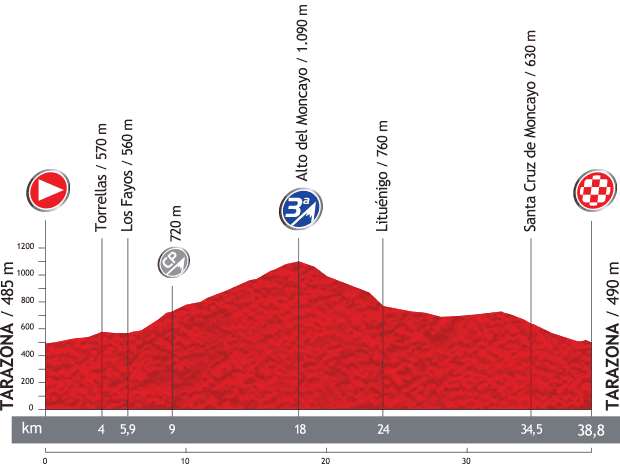
Vuelta a España 2013 stage 12 profile
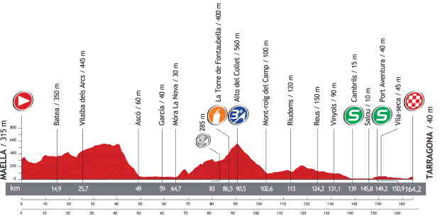
Stage map
Start: Maella
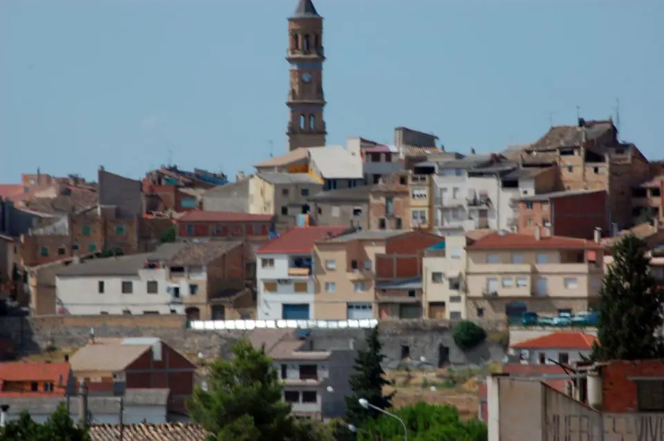
Maella is a municipality located in the province of Zaragoza, Aragon, Spain. The municipality has a population of 2,025 inhabitants, as of 2004. This town is located in La Franja, the local dialect is a variant of Catalan.
Finish: Tarragona
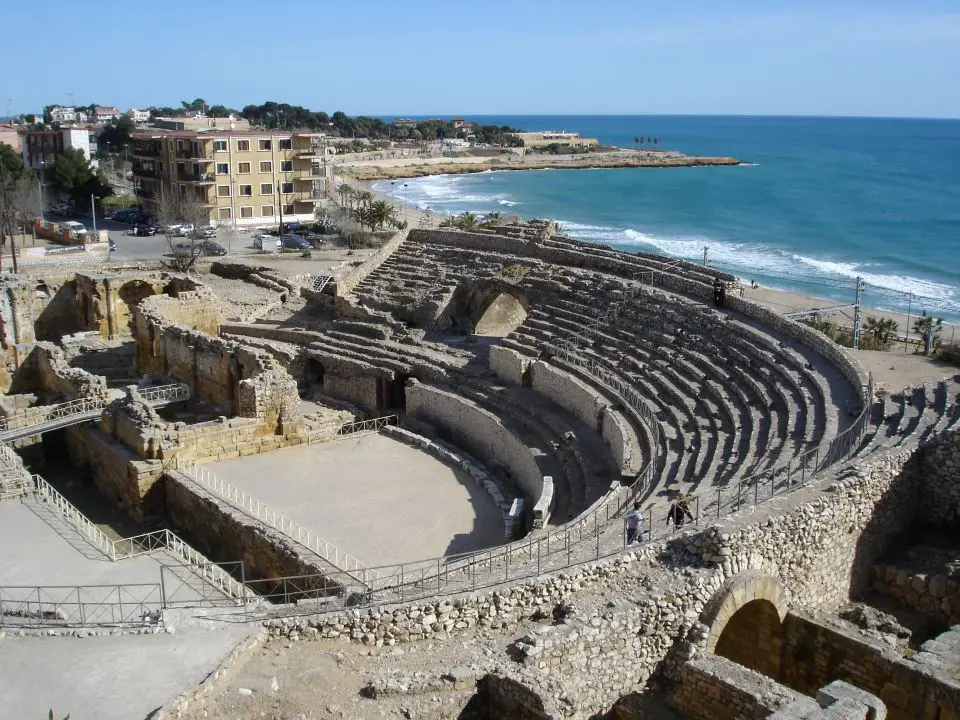
Tarragona is a city located in the south of Catalonia on the north-east of Spain, by the Mediterranean. It is the capital of province of the same name and of the Tarragonès comarca. Geographically, it is bordered on the north by the province of Barcelona and the province of Lleida. The capital city has a population of 134,085 inhabitants.he Roman ruins of Tarraco have been designated a World Heritage Site by UNESCO.
Part of the bases of large Cyclopean walls near the Cuartel de Pilatos are thought to pre-date the Romans. The building just mentioned, a prison in the 19th century, is said to have been the palace of Augustus. The 2nd century amphitheatre, near the sea-shore, was extensively used as a quarry after the fall of the Western Roman Empire, and but few vestiges of it now remain. A circus, c. 450 m long, was built over in the area now called Plaça de la Font, though portions of it are still to be traced. Throughout the town Latin, and even apparently Phoenician, inscriptions on the stones of the houses mark the material used for buildings in the town.
Two ancient monuments, at some little distance from the town, have, however, fared rather better. The first of these is the Aqüeducte de les Ferreres, which spans a valley about 4 km north of the city. It is 217 m (711.94 ft) in length, and the loftiest arches, of which there are two tiers, are 26 m (85.30 ft) high. There is a monument about 6 km along the coast road east of the city, commonly called the “Tower of the Scipios”; but there is no authority for assuming that they were buried here.
Other Roman buildings include:
- the walls
- the capitol, or citadel
- the Forum
- the palace of Augustus, called the house of Pilate
- the circus or amphithéâtre
- the so-called tower, or sepulchre, of the Scipios
- arch of Sura, or of Bara
- the Aurelian Way
The city is also home to the National Archaeological Museum of Tarragona.
Sources
- La Vuelta official website
- Maella on Wikipedia
- Tarragona on Wikipedia
- Top 18 fastest Paris-Roubaix editions - April 7, 2024
- Col de Tourmalet [Amazing photo from the 1953 Tour de France] - January 11, 2024
- Bernard Hinault and Francesco Moser, 1981 Paris-Roubaix - December 8, 2023
