Tour de France 2013 Stage 11 is a 33 km individual time trial stage (ITT) from Avranches to Mont-Saint-Michel.
Previous stage: Tour de France 2013 stage 10 details
Next stage: Tour de France 2013 stage 12 details
Tour de France 2013 Stage 11 quick info
- DATE July 10, 2013, Wednesday
- STAGE TYPE Individual Time Trial (ITT)
- START-FINISH Avranches (88 m) > Mont-Saint-Michel (6 m)
- LENGTH OF THE COURSE 33 km
- DIFFICULTY
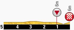
Tour de France 2013 Stage 11 profile
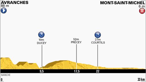
Last kilometers
Avranches
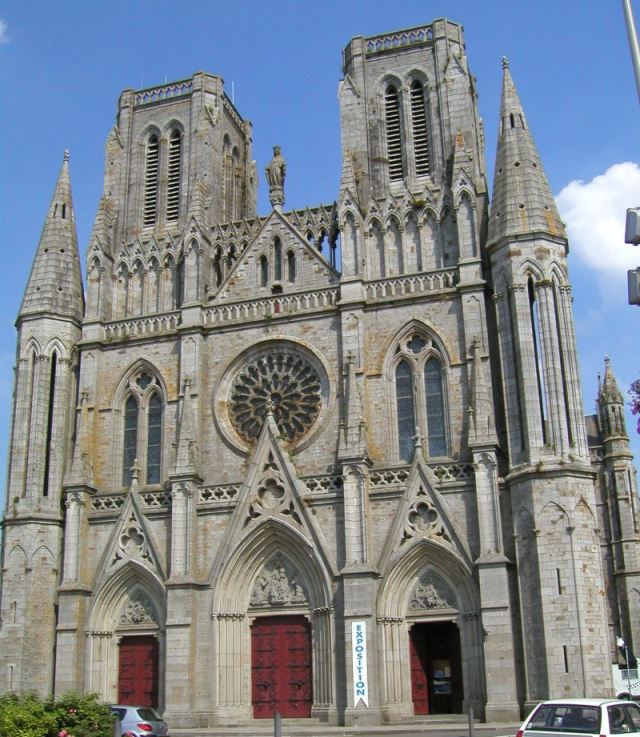
Avranches is a commune in the Manche department in the Basse-Normandie region in northwestern France. It is a sub-prefecture of the department.
A museum houses the collection of manuscripts of Mont Saint-Michel, deposited in the municipal archives during the French Revolution. It is one of the largest collections of medieval illuminated manuscripts in France, outside national and university libraries.
Formerly dominated by the cathedral, where Henry II did penance, an open grassed area La Plate-Forme overlooking the bay towards Mont Saint-Michel displays only a few remnants of the destroyed building.
The major church Notre Dame des Champs was constructed in Gothic Revival style in the 19th century to restore the religious life of the town after the destruction of the cathedral. A smaller church Saint Gervais houses a treasury, best known for the purported skull of Saint Aubert complete with hole where the archangel Michael’s finger pierced it (probably a prehistoric trepanned skull).
The botanical gardens were founded in the grounds of the former Franciscan convent in the late 18th century. The expansion and introduction of exotic species in the 19th century and the location of the gardens overlooking the bay made the gardens an important sight in the town.
The Manoir de Brion, an ancient Benedictine priory of Mont Saint-Michel, is located in Dragey.
Mont-Saint-Michel
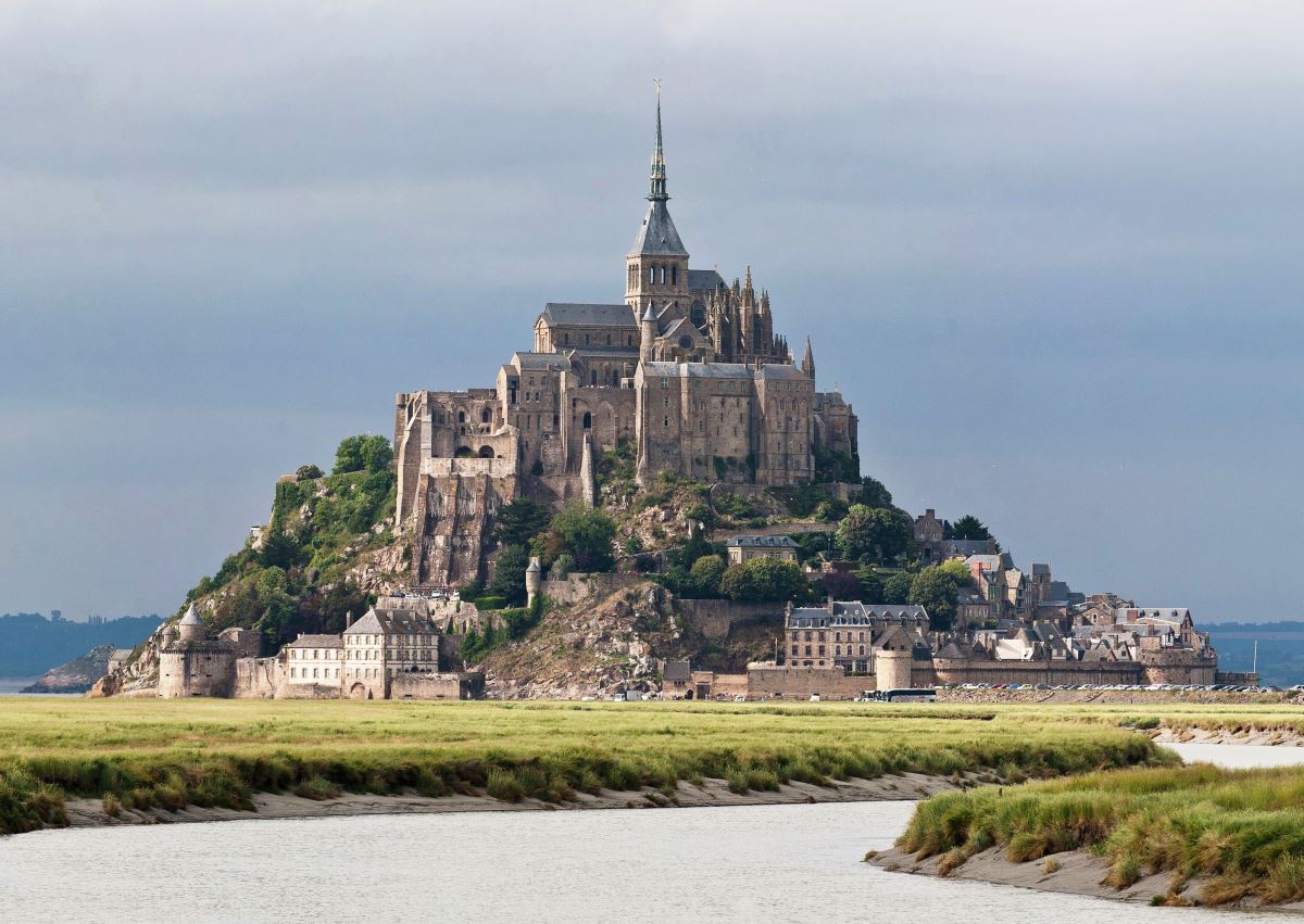
Le Mont-Saint-Michel is a tidal island and mainland commune in Normandy, France.
The island has held strategic fortifications since ancient times, and since the eighth century AD has been the seat of the monastery from which it draws its name. The structural composition of the town exemplifies the feudal society that constructed it. On top God, the abbey and monastery, below this the Great halls, then stores and housing, and at the bottom, outside the walls, fishermen and farmers’ housing.
One of France’s most recognizable landmarks, Mont Saint-Michel and its bay are part of the UNESCO list of World Heritage Sites and more than 3 million people visit it each year.
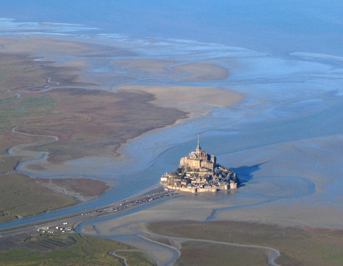
Mont Saint-Michel was previously connected to the mainland via a tidal causeway, i.e., a trackway covered at high tide and revealed at low tide. This connection has been altered over the centuries. The coastal flats have been polderised to create pastureland, thus the distance between the shore and the south coast of Mont Saint-Michel has decreased, and the Couesnon River has been canalized, reducing the dispersion of the flow of water, and thereby encouraging a silting-up of the bay. In 1879, the tidal causeway was converted into a raised or dry causeway. This prevented the tide from scouring the silt around the mount.
On 16 June 2006, the French prime minister and regional authorities announced a €164 million project (Projet Mont-Saint-Michel) to build a hydraulic dam using the waters of the river Couesnon and of tides to help remove the accumulated silt deposited by the rising tides, and to make Mont Saint-Michel an island again. It was projected to be completed by 2015.
The construction of the dam began in 2009 and is now complete. The project also included the removal of the causeway and its visitor car-park. It will be replaced by a light bridge, allowing the waters to flow freely around the island, which will improve the efficiency of the now operational dam, and a replacement car-park on the mainland. Visitors will use small shuttles to cross the future bridge which will still be open to pedestrians and unmotorized vehicles.
Sources
- Tour de France official website
- Mont-Saint-Michel on Wikipedia
