Tour de France 2013 stage 16 is a hilly stage from Vaison-la-Romaine to Gap. The length of the course is 168 km.
Previous stage: Tour de France 2013 stage 15 details
Next stage: Tour de France 2013 stage 17 details
Tour de France 2013 stage 16 quick info
DATE July 16, 2013, Tuesday
STAGE TYPE Hilly
START-FINISH Vaison-la-Romaine (264 m) > Gap (745 m)
LENGTH OF THE COURSE 168.0 km
DIFFICULTY
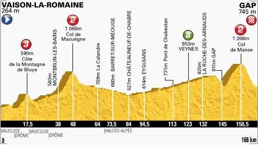
Tour de France 2013 stage 16 profile
Mountain passes & hills
- km. 17.5 Côte de la Montagne de Bluye (590 m), 5.7 kilometer-long climb at 5.6% (category 3)
- km. 48.0 Col de Macuègne (1,068 m), 7.6 kilometer-long climb at 5.2% (category 2)
- km. 156.5 Col de Manse (1,268 m), 9.5 kilometer-long climb at 5.2% (category 2)
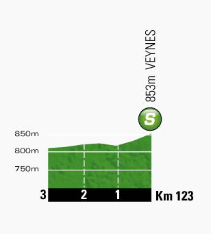
Intermediate sprint
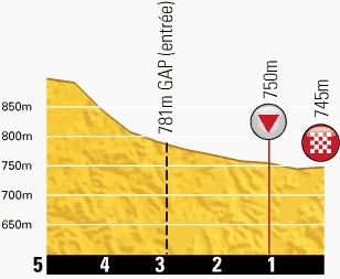
Last kilometers
Vaison-la-Romaine
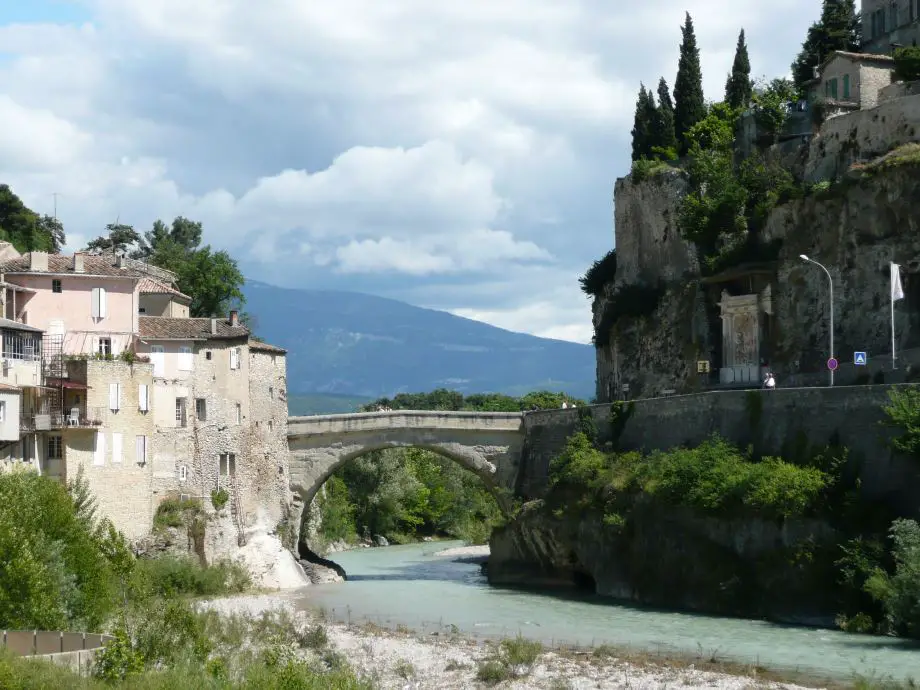
Vaison-la-Romaine (Latin: Vasio Vocontiorum) is a commune in the Vaucluse department in the Provence-Alpes-Côte d’Azur region in southeastern France.The historic section is in two parts, the Colline du Château on a height on one side of the Ouvèze, the “upper city” and on the opposite bank, the “lower city” centered on the Colline de la Villasse.
One of the most interesting aspects of the town is its geography, and its Roman ruins. The Roman ruins and the modern town are in the valley on the banks of the river Ouvèze which is crossed by an ancient bridge from the 1st century AD.
The medieval town is high on the rocky cliff. The valley floor was safe from attack in Roman and modern times. In the Middle Ages attacks were frequent, and the town retreated up-hill to a more defensible position.
The apse of the Church of St. Quenin, dedicated to Saint Quinidius, seems to date from the eighth century; it is one of the oldest in France.
As a whole the cathedral dates from the 11th century, but the apse and the apsidal chapels are from the Merovingian period.
The Roman ruins lie in the valley on the banks of the river Ouvèze which is crossed by a Roman bridge from the 1st century AD. The Roman ruins are located in two main areas: La Villasse and Puymin.
Several large and rich town houses have been excavated:
- The house of the Dolphin (2,700 m2): It owes its name to a white marble fountainhead portraying a cupid riding a dolphin. The structure of the house indicates it was built in stages over a period of about 250 years. About 30 BC it was a farmhouse of area 1,400 m2 built on a different alignment to the later street grid and with a main entrance to the south. The main building consisted of four rooms arranged around a colonnaded courtyard (peristyle). To the west lay several agricultural outbuildings and a small heated building, probably a thermal bath. 50 years later, water and sewage pipes were added leading to greatly improved living standards. Around 80 AD, the house was extended over the strip of land up to the new pedestrian street. A new main entrance was built to the north, the peristyle was extended eastwards and adorned with a pond and the upper floor was enlarged.
- The house of the Laurelled Apollo (2,000 m2)
- The house of the Arbour (3,000 m2)
- The house of the Peacock (1,000 m2)
Gap
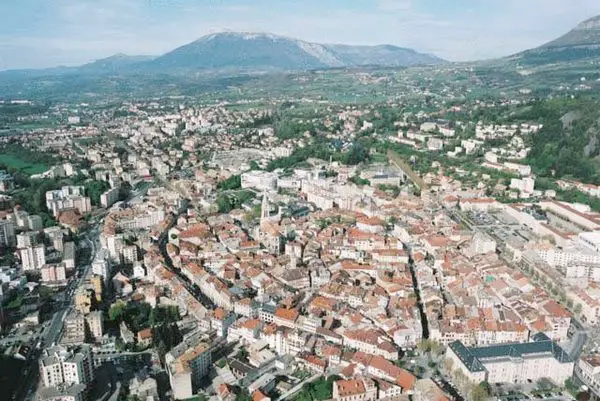
Gap is a commune in southeastern France, the capital of the Hautes-Alpes department. At a height of 750 m above sea level, it is France’s highest prefecture (departmental capital).
Gap hosted a Tour de France stage 21-time in history.
Main sights of Gap include:
- The Departemental Museum of the Hautes-Alpes houses the mausoleum of François de Bonne (Duke of Lesdiguières, Constable of the Haut-Alpin) carved in the black marble of the Champsaur by Jacob Richier.
- The pedestrian center made of small passages and pleasant terraces revolves around place Jean-Marcellin.
- Bronze by Cyril de La Patellière, “The Light”, by order of Mayor Pierre Bernard-Reymond in 2006.
- The Parc de la Pépinière
- The clock tower
- The town hall
- The Church of Saint André les Cordeliers
- The Cathedral of Notre-Dame and Saint-Arnoux was built from 1866 to 1904 according to the plans of Charles Laisné. This Neo-Gothic building replaces a medieval construction.
- The Conservatoire botanique national alpin de Gap-Charance, situated north-west of Gap
Sources
- Tour de France official website
- Vaison-la-Romaine on Wikipedia
- Gap on Wikipedia
