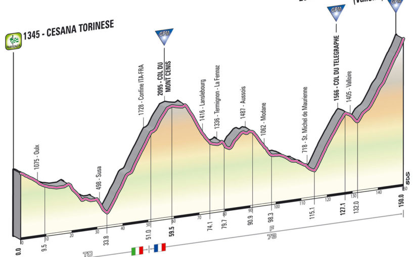
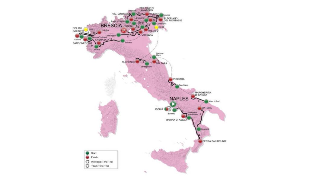
Giro d’Italia 2013 Stage 15 is a High Mountain stage with summit finish. It will start from Cesana Torinese and finish at the legendary Col du Galibier (from Valloire). The length of the course is 150 kilometers. The route also contains epic climbs of Col du Mont Cenis and Col du Télégraphe.
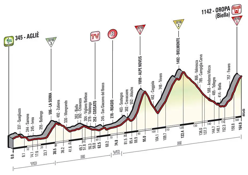
Previous stage: Giro d’Italia 2013 Stage 14 details
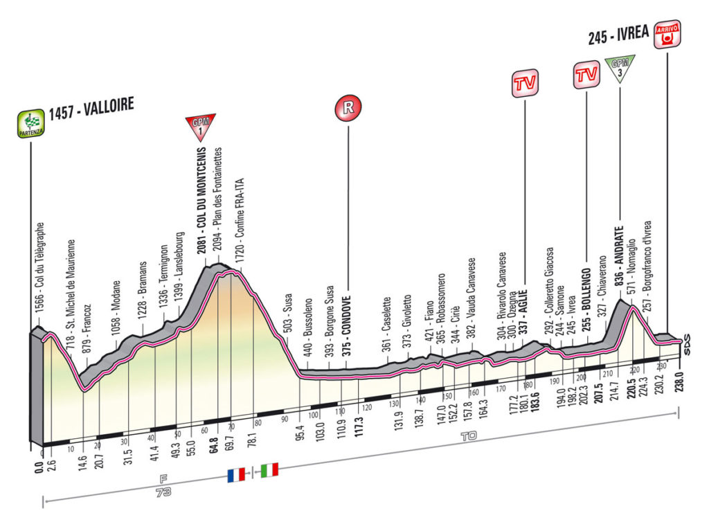
Next stage: Giro d’Italia 2013 Stage 16 Details
Giro d’Italia 2013 Stage 15 quick info
- DATE: May 19, 2013, Sunday
- STAGE TYPE: High Mountain with Summit Finish
- START-FINISH: Cesana Torinese (1345 m) > Col du Galibier (Valloire) (2642 m)
- LENGTH OF THE COURSE: 150 km
- DIFFICULTY:
Stage 15 of the Giro d’Italia sees a first for the Corsa Rosa, a summit finish on the mighty French climb of the Col de Galibier. It comes at the end of a very tough 149 km stage, and we went to assess just how pivotal it could prove to be.
Stage 15 is the last stage before the second rest day, so the battle for the general classification will be incredibly fierce.
The first climb of the day is the Col du Mont Cenis, a huge ascent of 25km with an average gradient of 6.2%. It’s unlikely to be decisive given what comes next for the riders.
The Col du Telegraph is 11km with an average of 7%, but there is virtually no descent at all from the summit to the slopes of the final climb of the Galibier.
18 kilometers of ceaseless climbing stand between the riders and the finish, and although it will be difficult to predict who will win the stage, it will doubtless be one of the strongest riders at the Giro. Altitude will play a big part as the finish lies at over 2600 meters.
Giro d’Italia 2013 Stage 15 profile
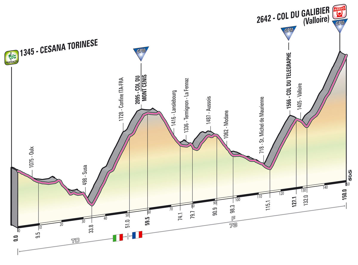
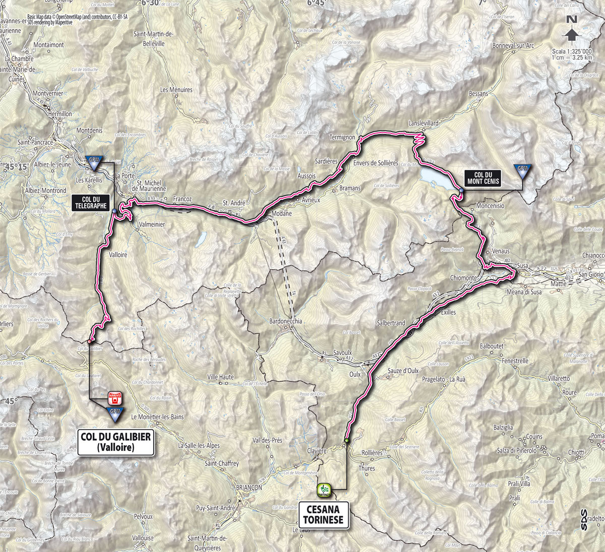

The stage is starting in Italy and finishing in France.
There are 3 main climbs in the stage route, and all of them are in France:
- Col du Mont Cenis (59.5th km, 2095 m): starting at 33.8th kilometer near Susa (380 m). Riders will gain 1715 meters in 25.7 kilometers (average 6.7%). The peloton will pass the Italia-France border at 51st kilometer, with the elevation of 1728 meters.
- Col du Télégraphe (127.1st km, 1566 m): starting at 115.1st kilometer at St. Michel de Maurienne (718 m). Riders will gain 848 meters in 12 kilometers (average 7%, max. 11%).
- Col du Galibier (from Valloire) (150th km, 2642 m), Summit finish: starting at 132nd kilometer at Valloire (1405 m). Riders will gain 1237 meters in 18 kilometers (average 6.8%, max. 11%).
Giro d’Italia 2013 Stage 15 start town: Cesana Torinese
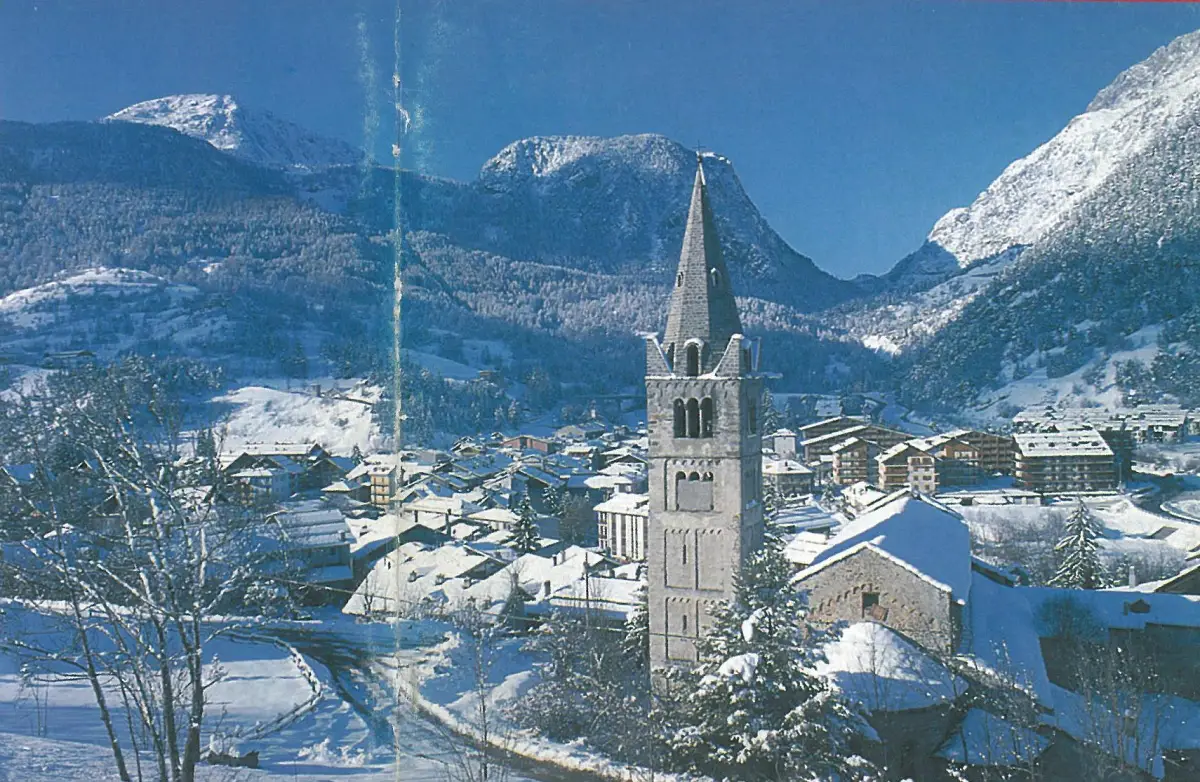
Cesana Torinese is a comune (municipality) in the Province of Turin in the Italian region Piedmont, located about 70 km west of Turin, on the border with France.
Cesana Torinese is sited on the route of the Roman road leading from the Po Valley to Gaul. During the Middle Ages, the road lost its commercial importance but retained its military significance.
In 1928 some previously independent towns (Désèrtes, Bousson, Fenils, Mollières, Solomiac, and Thures) were merged with that of Cesana. Cesana was one of the venues for the 2006 Winter Olympics, hosting the biathlon, women’s alpine skiing, bobsleigh, luge, and skeleton. It also hosted the biathlon for the 2007 Winter Universiade.
Mont Cenis
Mont Cenis (Italian: Moncenisio) is a massif and pass (el. 2081 m / 6827 ft) in Savoie in France which forms the limit between the Cottian and the Graian Alps.
The pass connects Lanslebourg-Mont-Cenis in France in the northwest with Susa in Italy in the southeast. It was used as part of the border between the two countries until the 1947 Treaty of Paris but is now located completely in France.
Col du Télégraphe
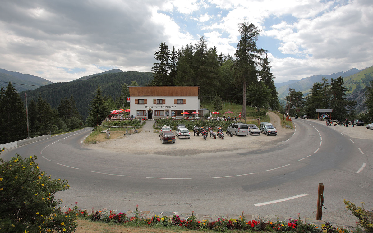
Col du Télégraphe is a mountain pass in the French Alps situated above the Maurienne valley between the eastern end of the massif d’Arvan-Villards and the massif des Cerces. The pass links Saint-Michel-de-Maurienne to the north and Valloire to the south, as well as forming an access point to the Col du Galibier via its north face. The route is often used during the ascent to Col du Galibier in the Tour de France and is thus popular with cyclists.
Giro d’Italia 2013 Stage 15 finish: Col du Galibier
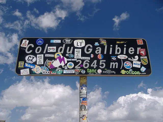
Col du Galibier (elevation: 2,645 meters or 8,678 feet) is a mountain pass in the southern region of the French Dauphiné Alps near Grenoble. It is the ninth highest paved road in the Alps and the sixth highest mountain pass. It is often the highest point of the Tour de France.
Giro d’Italia will reach the top of the Galibier for the first time in history.
The Col du Galibier was first used in the Tour de France in 1911; the first rider over the summit was Emile Georget, who, with Paul Duboc and Gustave Garrigou were the only riders not to walk. The original summit was at 2556 meters. While the tunnel was closed from 1976 until 2002, the tour route went only over the pass closer to the mountain peak at 2645 meters. In 2011, the Tour de France went through the tunnel for the first time during the 19th stage from Modane Valfréjus to L’Alpe d’Huez (Pierre Rolland won the stage).
Sources
- Cesana Torinese on Wikipedia
